Open almost any photo tool and the interface makes the same quiet assumption: your catalog is a list. A very long list, paginated or infinite-scrolled, but structurally no different from a spreadsheet — fifty thumbnails per screen, click, fifty more. That's an interface built for one job: retrieval. Find the file, open the file. It was never built for the other job a serious archive eventually demands of you — understanding what you've actually made — and a scrollbar, no matter how smooth, cannot do that job for you.
The Scrollbar Was Never a View
Scroll far enough through five thousand photos and you stop seeing individual images — you start seeing a blur of near-identical thumbnails, punctuated by the occasional one that catches your eye by accident. Whatever sits next to whatever in that scroll is decided by filename or import date, not by anything about the photographs themselves. Photo #412 and photo #4,891 might be the two most visually related frames in your entire career — same light, same gesture, same quiet mood shot four years apart — and the interface will never once put them side by side, because a list has no concept of 'side by side' beyond the order you loaded it in.
This is the same failure as the folder, just wearing different clothes. A folder forces you to decide a category before you can find anything in it. A grid forces you to decide an order — usually chronological — before you can look at anything in it. Both flatten a catalog that is, in reality, not linear at all. A body of work has shape: dense regions where you keep returning to the same kind of image, sparse regions you've barely touched, clusters that turn out to be more connected to each other than you'd have guessed. None of that shape survives being poured into a list.
A Catalog Is a Space, Not a List
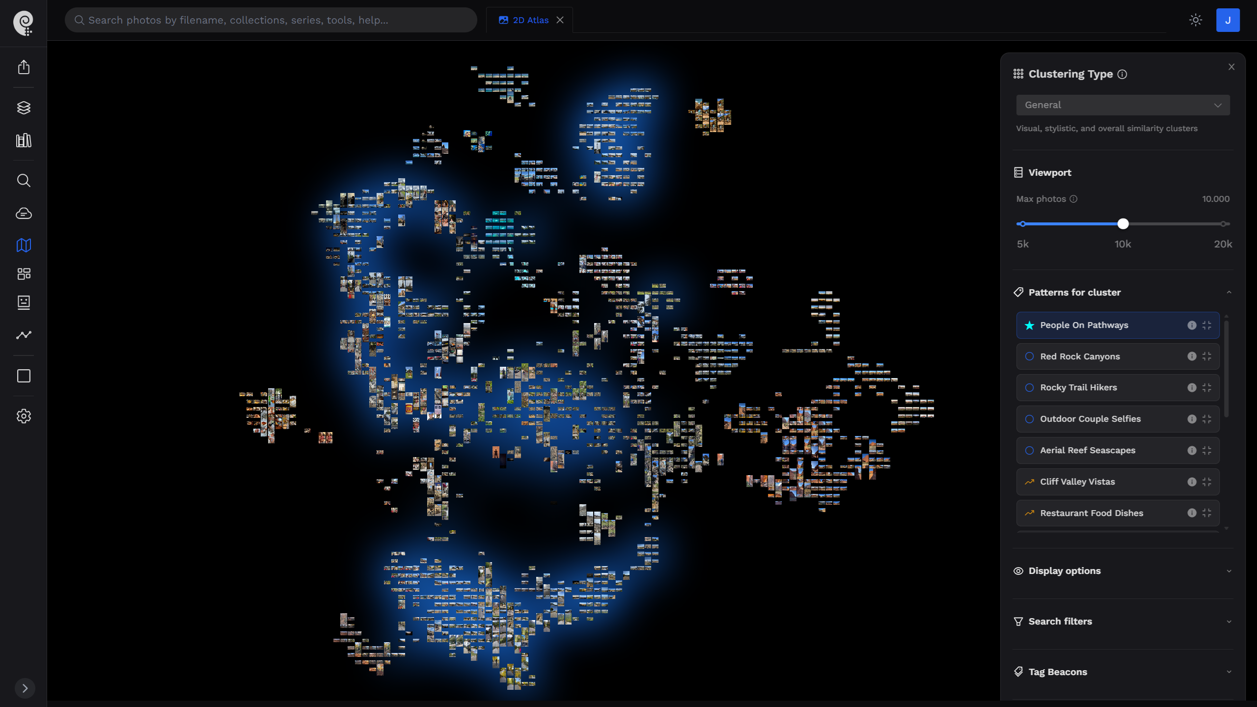
The Atlas — available in both 2D and 3D — starts from a different premise: don't flatten the catalog, map it. Every photograph is run through computer vision to extract a high-dimensional embedding, a numerical description of what it visually is: composition, color palette, subject matter, lighting, mood. That embedding is then projected down into two or three dimensions with UMAP (Uniform Manifold Approximation and Projection), a dimensionality-reduction technique built specifically to preserve relationships during the drop: images that are visually alike end up near each other in the final space, images that are unalike end up far apart.
Open the 2D Atlas and the resemblance to a night-time satellite image isn't a stylistic choice — it's an honest visualization. Bright, dense patches are regions where your camera keeps returning to the same kind of frame: same light, same subject, same visual language, shot again and again until it forms a landmass. The dark space between those patches is real too. It isn't a rendering gap — it's the visual territory you simply haven't photographed, an accurate map of the gaps in a body of work, not just its concentrations.
Two Ways to Fly
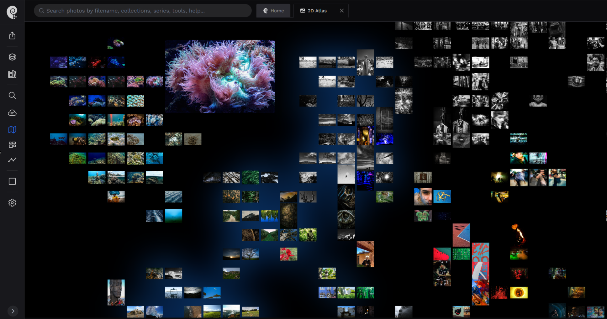
The 2D Atlas is the map you'd check before a trip: a flat, top-down view of the entire catalog at once, built for spotting continents and gaps in a single glance. It's the fastest way to answer 'what does my archive actually look like,' because it shows you everything at the same scale, at the same time.
The 3D Atlas is the trip itself. Same underlying space, same embeddings, same clusters — but now you're inside it, flying between regions, rotating a cluster to see it from another angle, diving into a dense patch until individual photographs resolve out of the blur. Where the 2D view answers 'what shape is my catalog,' the 3D view answers 'what does it feel like to actually stand inside that region of my own work.'
A grid asks you to look at your photographs one at a time, in an order someone else decided. A map lets you decide where you want to go.
Both modes share the same navigation logic, and it isn't limited to raw visual similarity. The same catalog can be organized by different lenses depending on what you're trying to see:
- Contextual — grouped by content and subject matter
- Narrative — arranged by time and story, so a project or a year unfolds in order
- Visual Accents — clustered by standout visual elements rather than overall similarity
- Overall Style — organized by the aesthetic and stylistic fingerprint of each image
Fly through a real catalog
Explore a live 3D Atlas built from an actual photography archive — no upload required.
What a Map Reveals That a List Never Could
This is where the Atlas stops being a navigation convenience and starts being something closer to a mirror. Switch to Narrative mode and watch a decade of work arrange itself by time: you can see a stylistic shift happen mid-catalog — the moment your compositions got tighter, or your color palette went from saturated to desaturated — as an actual, visible migration across the map, not a fact you'd have to reconstruct from memory.
Switch to Overall Style and a photograph you took for a client in one country will sometimes land right next to one you took for yourself in another, four years apart, because the model can see something about your eye that you filed under two completely unrelated projects. That's not something you can stumble into by scrolling. It requires the whole catalog to exist in the same space at the same time, so that distance itself becomes information — and, for once, you're the one looking at your own work from the outside, instead of trying to remember it from the inside.

Nobody Else Shows You the Whole Thing
This isn't a case of doing an existing feature better — it's hard to compare because the feature doesn't really exist elsewhere. Lightroom's smart collections, Google Photos' object clustering, and visual-similarity tools like Excire all work adjacent to this problem, but they all answer a narrower question: 'what else looks like this one photo I've selected.' That's useful, and it's a different problem from the one this piece is about. It's still a query, run one photo or one phrase at a time — never a view of the entire archive at once, rendered as a single, continuous, explorable space.
None of the major cataloging tools — Lightroom Classic, Capture One, Google Photos, Mylio, digiKam — render your whole catalog as a place you can actually enter. They browse. The Atlas is a first attempt at letting you see the shape of everything you've ever shot, all at once, from the outside.
From Region to Sequence
Seeing the shape of an archive is the destination for some photographers and the starting point for others. Once a region of the map reveals itself — a cluster of images that share a mood, a light, a subject — it becomes raw material: the start of a sequence, a portfolio section, or an exhibition wall, built from photographs that belong together because a space said so, not because a filename happened to put them in the same export folder.
A folder can only tell you where you put something. A grid can only show you what's next in line. Neither was ever built to answer the question that actually matters once an archive gets large enough to outgrow memory: not 'where is this photo,' but 'what does all of this, together, actually look like — and what does it say about the work?' That's not a retrieval problem anymore. It's a map.